
The Choquequirao trek takes you to one of the most impressive Inca sites in Peru, often called the “sister of Machu Picchu”, but with only a handful of visitors a day. There is no road and no train: the only way in is on foot, down into the deep Apurímac canyon and up the other side. This complete guide covers the route, the difficulty, the altitude, the best time to go, the campsites, what to pack, and the history of Choquequirao, the “Cradle of Gold”.
Choquequirao trek at a glance
| Trailhead | Cachora (about 2,900 m), about 4 hours by road from Cusco |
| Choquequirao ruins | About 3,050 m |
| Lowest point | Apurímac River, about 1,500 m |
| Distance | About 60 km round trip |
| Duration | 4 days is the classic; 3 days is possible for fit hikers |
| Difficulty | Hard: about 1,500 m down and 1,500 m up, twice |
| Best time | May to September |
| Visitors | Very few compared with Machu Picchu |
Why do the Choquequirao trek?
- Inca ruins almost to yourself: Machu Picchu receives well over a million visitors a year; at Choquequirao, it is common to explore whole sectors alone.
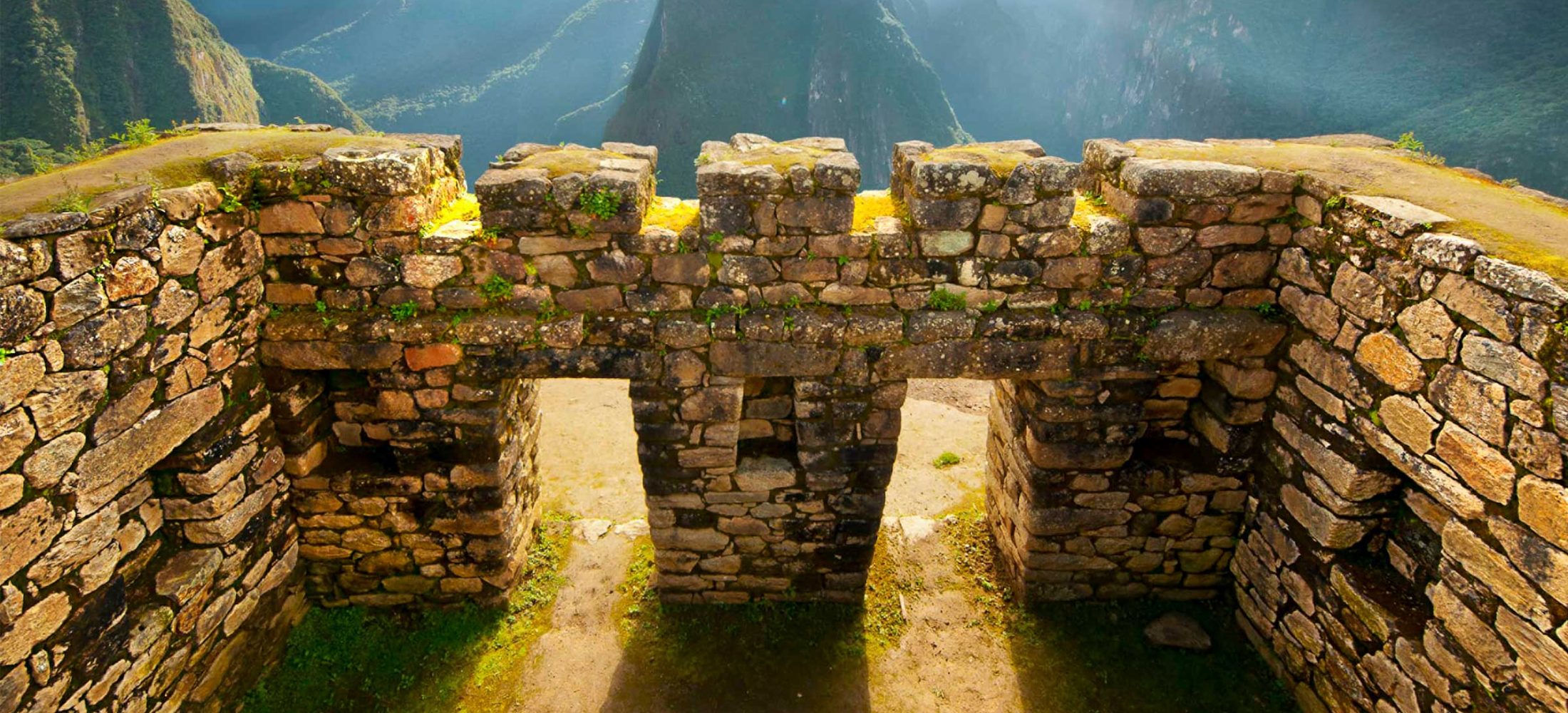
- A huge site: plazas, temples, fountains, canals and terraces spread over a mountain ridge above the Apurímac canyon, and a large part is still covered by forest.
- The llama terraces: a set of terraces decorated with white stone mosaics of llamas, unique in Inca architecture.
- The landscape: one of the deepest canyons in the Andes, with condors and snow peaks on the horizon.
Choquequirao trek itinerary (4 days)
Day 1: Cusco – Cachora – Capuliyoc – Chiquisca or Playa Rosalina
Early drive from Cusco to Cachora. The trail starts with a gentle walk to the Capuliyoc viewpoint, with the first view of the Apurímac canyon, then a long, steep descent to the campsites of Chiquisca or Playa Rosalina, near the river.
Day 2: Playa Rosalina – Santa Rosa – Marampata – Choquequirao
The hardest day: cross the Apurímac River and climb about 1,500 m on zigzags to Santa Rosa and Marampata, from where you see Choquequirao for the first time. A last, almost flat section leads to the campsite next to the ruins.
Day 3: Choquequirao ruins – back to Chiquisca
A guided morning at the ruins: the main plaza, the upper sector, the ceremonial platform with its views of the canyon and the llama terraces. In the afternoon, descend toward the river.
Day 4: Chiquisca – Capuliyoc – Cachora – Cusco
The final climb back to Capuliyoc, then the drive to Cusco, arriving in the evening.
See the details and prices of our Choquequirao Trek 4 Days (from USD 380) and Choquequirao Trek 3 Days (from USD 360), or all options on our Choquequirao trek page.
How hard is the Choquequirao trek?
The Choquequirao trek is harder than the Inca Trail or the Salkantay Trek in terms of effort, even though it is not as high. The challenge is the canyon: on the way in, you descend about 1,500 m to the Apurímac River and climb about 1,500 m back up to the ruins, and you repeat it on the way out. The trail is well built and zigzags up the slopes, but it is steep, hot in the lower sections and exposed to the sun.
- It is for hikers in good physical condition; train with long hikes and stairs before the trip.
- Trekking poles help a lot on the long descents.
- Saddle horses or mules can be hired for the hardest sections.
Read how to physically prepare for Peru.
Altitude on the Choquequirao trek
The Choquequirao trek is lower than most treks around Cusco: the highest points are around 3,000 to 3,100 m, near Capuliyoc and the ruins, and the lowest is the Apurímac River at about 1,500 m. Altitude sickness is less of a problem than on Salkantay or Rainbow Mountain, but you start from Cusco at 3,400 m, so spend at least 2 days there to acclimatize. Read our guide to altitude sickness in Cusco.
Best time for the Choquequirao trek
The best months are May to September, the dry season, with clear skies and dry trails. April and October are good, with some showers. From November to March, the rainy season brings mud, slippery sections and occasional landslides; the trek is possible but harder, and the views are often cloudy. The bottom of the canyon is hot all year, often above 25 °C at midday, so start early and carry plenty of water.
Campsites and services
The campsites on the Choquequirao trek, run by local families, are among the best equipped in the Andes, with water, toilets, cold showers and small shops selling drinks and snacks. They are basic, so bring cash in soles in small notes. On our tours, the team carries the tents, kitchen and food, and the cook prepares all the meals.
Guided or independent?
The trail is clear and it is possible to hike it independently if you are experienced and carry your own camping gear and food. Most hikers go with a guided tour, which solves the transport to Cachora, the tents, food, mules and the guide, who explains the history of the site. On a guided trek, you usually get:
- Transport from Cusco to the trailhead and back
- A professional guide and a cook
- All meals and drinking water during the trek
- Tents, sleeping pads and dining tent
- Mules to carry the camping equipment
- A first aid kit and emergency oxygen
- The entrance ticket to Choquequirao
History of Choquequirao
Choquequirao, which means “Cradle of Gold” in Quechua, was built by the Incas in the 15th century, probably as a royal estate and ceremonial center linked to the Inca rulers who also built Machu Picchu. Its position, between the Andes and the Amazon, made it a link between regions, and after the Spanish conquest, it was one of the places connected to the Inca resistance in Vilcabamba.
The llama terraces are unique: white stones set into the dark walls form more than 20 figures of llamas walking up the slope. Some researchers believe they were made by workers brought from other regions, possibly from the Chachapoyas area in the north. Only part of the site has been cleared, and archaeologists believe much more remains hidden under the forest.
What to pack for the Choquequirao trek
- Original passport
- Hiking boots with good grip and trekking poles
- Light, breathable clothes for the hot canyon and a fleece and jacket for the nights
- Rain jacket or poncho
- Sleeping bag rated to about 0 °C
- Sunscreen, sunglasses, a hat and insect repellent
- Water bottles or a hydration bladder, at least 2 liters
- Flip-flops for the campsite showers, a headlamp and cash in soles
For more on Inca sites in the region, see UNESCO’s page on the Qhapaq Ñan, the Andean road system, and our Machu Picchu tours to combine both “sister” sites.
Frequently asked questions about the Choquequirao trek
How long is the Choquequirao trek?
About 60 km round trip from Cachora. Most people take 4 days; fit hikers can do it in 3.
Is the Choquequirao trek harder than the Inca Trail?
Physically, yes. It is lower, but the long descents and climbs in the Apurímac canyon make it more demanding.
How high is Choquequirao?
The ruins are at about 3,050 m, a little higher than Machu Picchu at 2,430 m.
Can I go to Choquequirao without a trek?
No. There is no road or train to the ruins; the only access is on foot from Cachora, or by a longer trek.
Can I combine Choquequirao and Machu Picchu?
Yes. A long trek of about 8 days links Choquequirao with Machu Picchu, or you can visit Machu Picchu by train after returning to Cusco.